Updated on Mar. 27, 2025, 11:19 AM
Two rounds of significant, widespread freezing rain will increase travel dangers and power outage risks across the province over the weekend
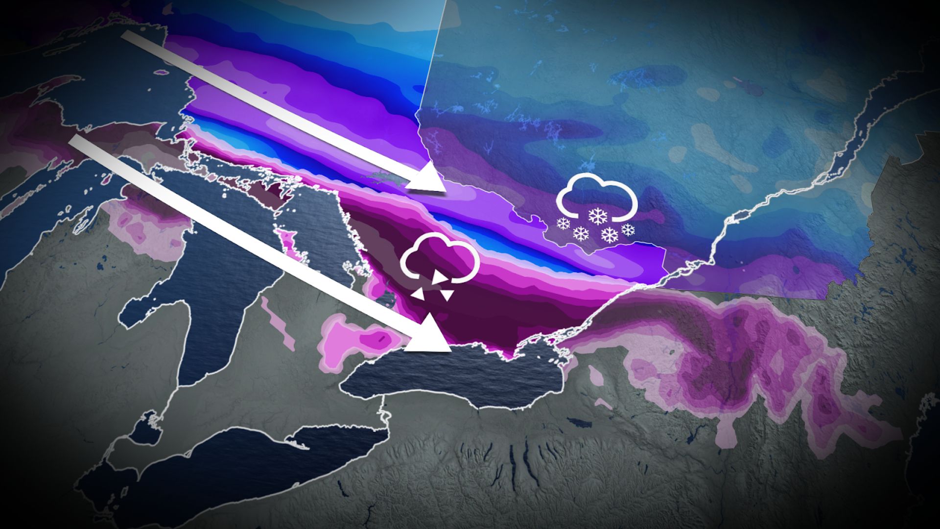
A long-duration ice storm is building up for the weekend across Ontario as sharply contrasting air masses collide over the province, leading to a prime setup for nasty weather.
The boundary between the two air masses will feature significant freezing rain, while south of the boundary will feature soggy rains, and north of the boundary will feature a hefty dose of spring snow.
Visit our Complete Guide to Spring 2025 for an in-depth look at the Spring Forecast, tips to plan for it and much more!
Significant ice buildup will likely lead to some major impacts as roadways become dangerously slippery and power lines become bogged down by the heavy ice. Folks should expect significant impacts to travel over the weekend, as well as prepare for localized power outages.
The ice, rain, and snow will come in two rounds over the weekend, lasting into the work week. Round one will begin Friday evening and last into Saturday, bringing prolonged freezing rain to the province. Round two will begin on Sunday as a new low pushes northeast into Quebec.
SEE ALSO: What weather can Canadian voters expect on April 28? A historical look
The storm setups could change, however, closer to the event due to the shifting nature of the boundary.
Be sure to check highway conditions and local weather alerts before heading out if necessary.