OMAHA, Neb. (WOWT) – The National Weather Service has finalized their damage survey of the tornadoes and large hail from last Thursday, April 17.
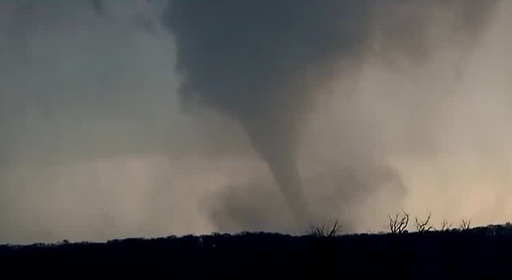
Two powerful, long-lived supercells moved across eastern Nebraska and western Iowa during Thursday afternoon into nightfall hours. These two supercells produced very large hail reaching up to 4″ in diameter, wind gusts up to 80 mph, and a few tornadoes.
The strongest tornado was the Bennington/Ft. Calhoun tornado, north of downtown Omaha. It was rated as an EF-3 tornado reaching estimated max wind gust at 140 mph.
The tornado touched down at 6:55 PM and lasted for 20 minutes impacting numerous houses, trees, and businesses. The worst damage was Dutch Hall Rd near 84th St.
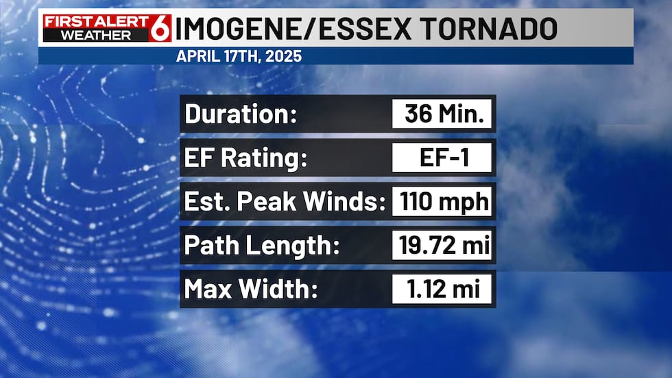
Another tornado touched down in southwest Iowa near Imogene and moved into the northern part of Essex. It was rated as an EF-1 tornado with estimated max wind speed at 110 mph. What was more impressive was the width of the tornado. It was estimated at over a mile wide.
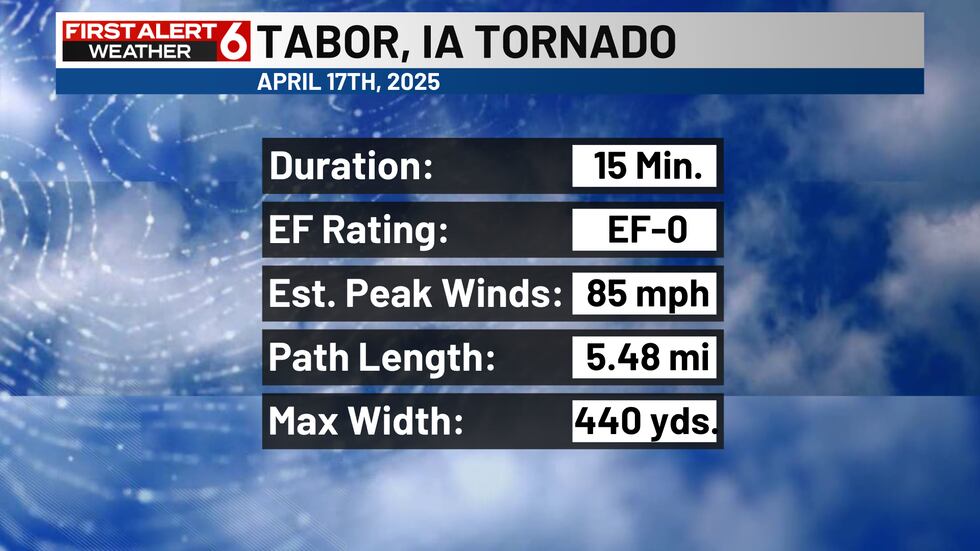
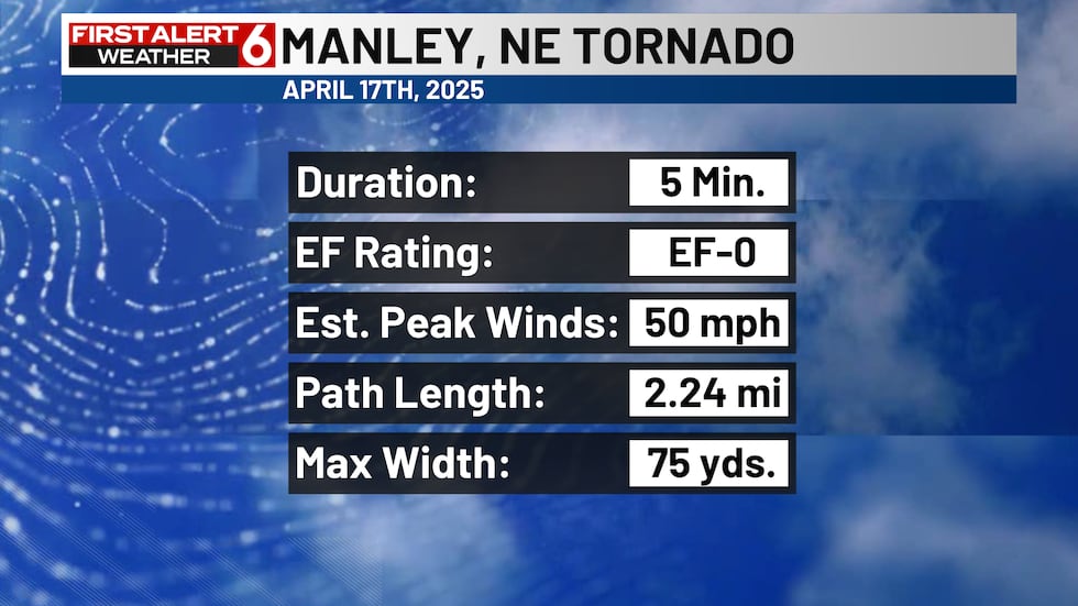
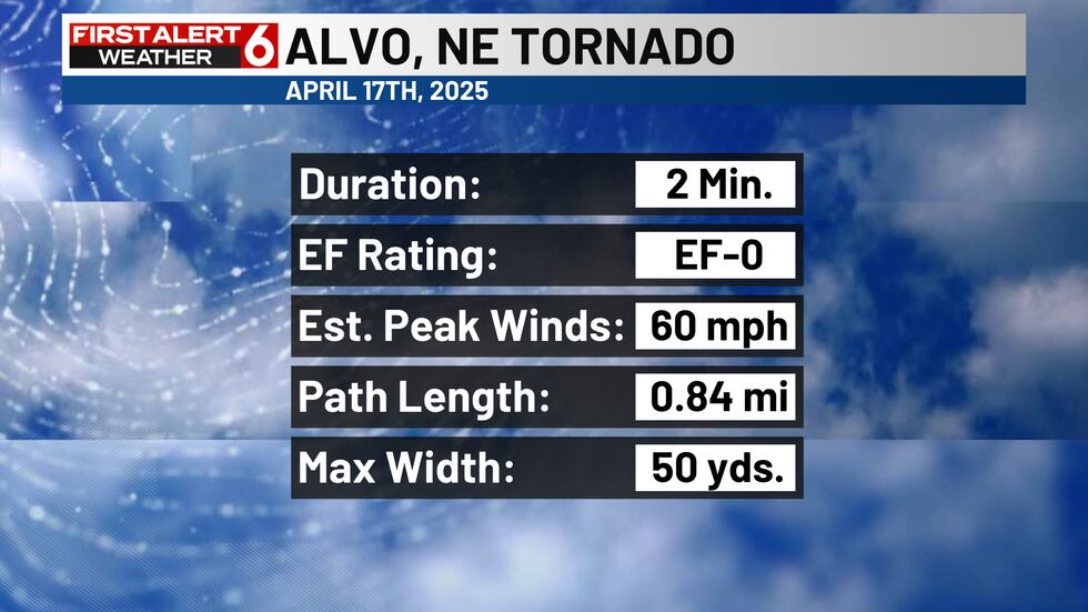
There were a few more brief tornadoes that touched down from the same storms, but they didn’t last very long nor were strong.
Hail was just as impactful, if not more damaging, to the metro as there was multiple reports of large hail reaching up to baseball size. The biggest hail reported was 4″ in diameter in Arlington, Nebraska. Majority of the hail reports were hail size between 2-3″ in diameter.


Mixed with the hail was strong winds reaching 70-80 mph causing severe damage to homes and businesses like in Fremont, Nebraska.
No major injuries or fatalities were reported with these storms.
—
Get a first alert to severe weather approaching your area. Download the First Alert 6 Weather app.
Copyright 2025 WOWT. All rights reserved.