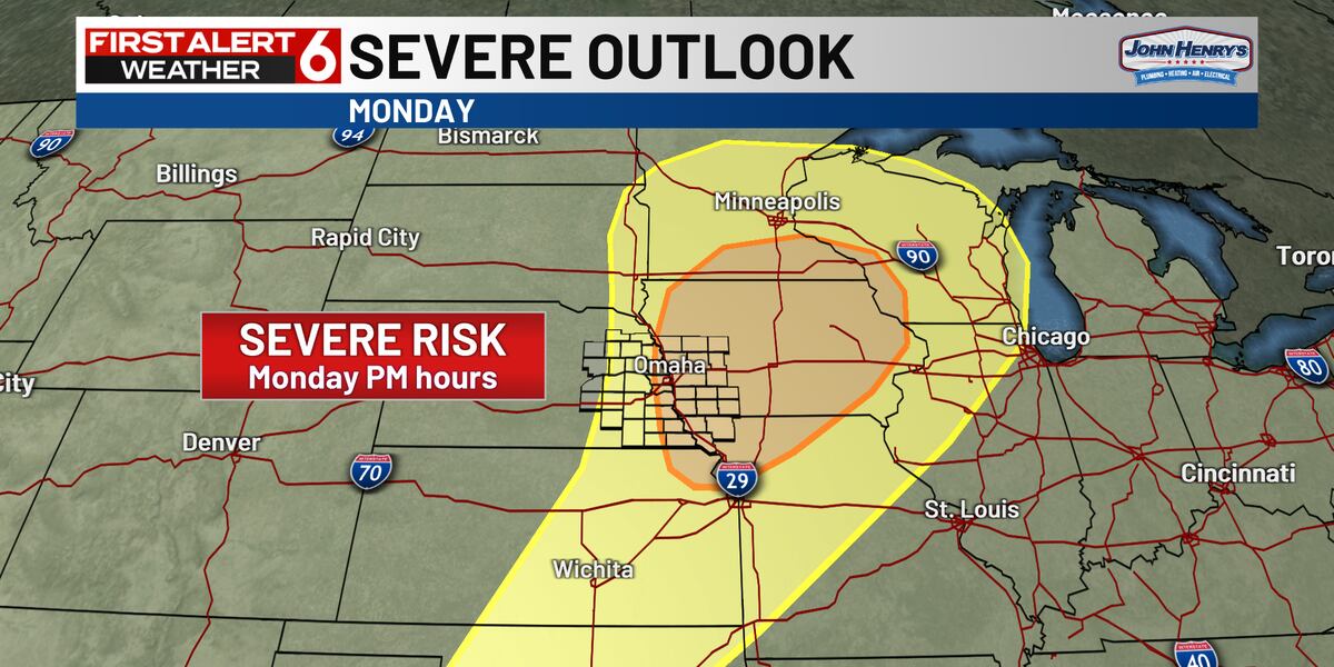
OMAHA, Neb. (WOWT) – Monday is a First Alert 6 Weather Day for the potential for strong storms to develop in the afternoon and evening.
A strong storm system will move through the middle of the country as next week begins, putting many areas under the risk for severe weather.
Out ahead of this system, temperatures will jump into the 80s with a muggy feel to the air. Southerly winds could gust over 40 miles per hour during the day.
Any storms that do develop in our area look to be rather scattered at this point.
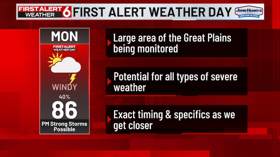
It’s possible that the storms start in our area and quickly move east and out.
However, if storms do start here, the ingredients would be there for all modes of severe weather to take place.
That includes the risk for tornadoes, large hail and gusty winds.
Stay with First Alert 6 as we get more data and refine the forecast over the coming days.
Copyright 2024 WOWT. All rights reserved.