Timeline & Key Impacts
- Tuesday Morning – Wednesday: A winter storm will bring a mix of snow, sleet, and freezing rain to the region.
- Tuesday: Heaviest snowfall expected north of U.S. 460, with more sleet and ice in southern areas.
- Wednesday: Brief lull in precipitation followed by additional round freezing rain. Southside mostly rain. All areas transition to freezing rain by late Wednesday.
Monday is the last (mostly) dry day of the week
Skies start mostly cloudy, then gradually become sunny, with a high near 49. You’ll want to finish up any outdoor activities and shopping as snow will quickly arrive by daybreak on Tuesday.
Significant Winter Storm Tuesday
The National Weather Service has issued a Winter Storm Warning from 6 am Tuesday until noon Wednesday.
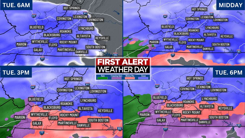
We’ve issued a First Alert Weather Day for Tuesday and Wednesday. Snow overspreads the area before daybreak Tuesday then gradually increases in intensity and coverage throughout the morning.
School closings and altered work schedules are likely as roads will become slick as the snowfall rates increase.
Afternoon
By late Tuesday afternoon, snow is likely to mix with sleet and freezing rain near and south of the 460 corridor as the atmosphere warms. This will lead to increasing amounts of ice (sleet & freezing rain).
Meanwhile, snow continues to fall for areas north of the 460 corridor where roads will become hazardous during the afternoon.
Evening & Overnight
Sleet and freezing rain will fall throughout the evening, diminishing in intensity later Tuesday night into early Wednesday morning.
SNOW AND ICE FORECAST
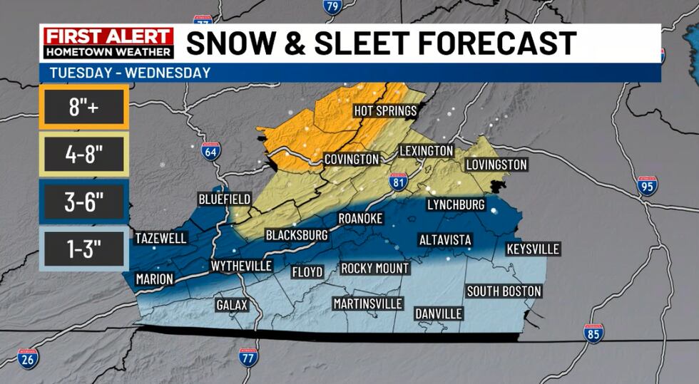
Snowfall Totals: Highest amounts expected along the VA/WV border and parts of the Shenandoah Valley down to the Route 460 corridor. Lighter snow amounts are expected the more you get toward the VA/NC state line.
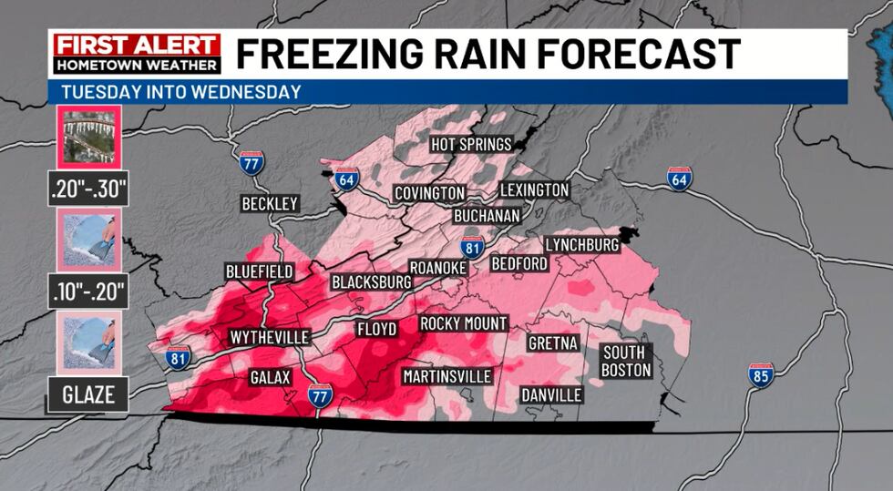
Ice Accumulation: Significant ice is possible along the Blue Ridge, especially near the VA/NC border. Ice could lead to power outages and hazardous roads.Possible
Temperatures are expected to warm after the event allowing crews to work on clearing the slushy mess.
- School Closings/Delays Likely Tuesday & Wednesday
- Worst Road Conditions: Tuesday afternoon into Tuesday night
- Flight delays/cancellations out of ROA & LYH
Freezing Rain & Rain Wednesday; Potential Flooding
Freezing will will return to areas near I-81 and the Blue Ridge Mountains Wednesday morning as rain falls over the southside. The freezing rain should transition to rain for all areas by Wednesday evening. Pockets of moderate to heavy rain could lead to runoff and flooding in low-lying areas. Rainfall of a quarter to a half of an inch is possible Wednesday into Wednesday night.
More Rain By The Weekend
Thursday and Friday are trending drier with some sunshine. However, an active storm track continues into Valentine’s Day weekend. Here are some of the highlights of the long-range forecast.
- Flooding Threat Grows: With repeated rainfall, small stream and river flooding becomes more likely as the week progresses.
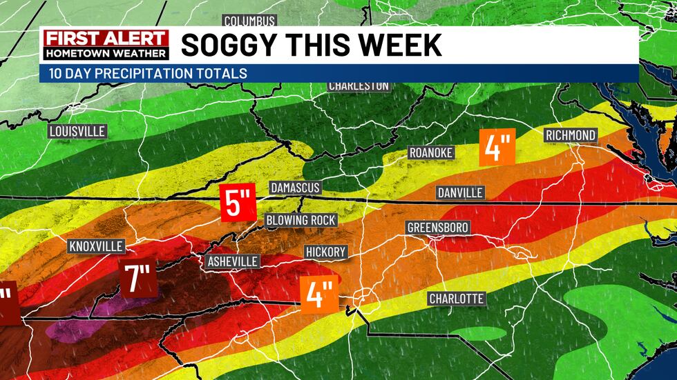
Stay alert for updates on the flood risk as we approach the end of the week.
Copyright 2024 WDBJ. All rights reserved.